


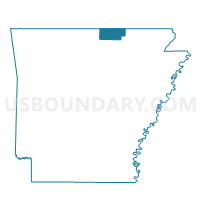
Benton Voting District, Fulton County, Arkansas
About
Outline

Summary
| Unique Area Identifier | 526493 |
| Name | Benton Voting District |
| County | Fulton County |
| State | Arkansas |
| Area (square miles) | 59.57 |
| Land Area (square miles) | 59.52 |
| Water Area (square miles) | 0.06 |
| % of Land Area | 99.90 |
| % of Water Area | 0.10 |
| Latitude of the Internal Point | 36.37241620 |
| Longtitude of the Internal Point | -91.84859100 |
Maps


Graphs
Select a template below for downloading or customizing gragh for Benton Voting District, Fulton County, Arkansas


Neighbors
Neighoring Voting District (by Name) Neighboring Voting District on the Map
- Cleveland Voting District, Fulton County, AR
- Fulton Voting District, Fulton County, AR
- South Fork Voting District, Fulton County, AR
- Strawberry Voting District, Fulton County, AR
- Union Voting District, Fulton County, AR
- Washington Voting District, Fulton County, AR
Top 10 Neighboring County Subdivision (by Population) Neighboring County Subdivision on the Map
- Benton township, Fulton County, AR (2,564)
- Fulton township, Fulton County, AR (1,049)
- Strawberry township, Fulton County, AR (742)
- Cleveland township, Fulton County, AR (514)
- South Fork township, Fulton County, AR (485)
- Washington township, Fulton County, AR (406)
- Union township, Fulton County, AR (303)